 Archeoplus
Vuiteboeuf (VD)
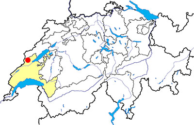
Canton: Vaud
Swiss topographic coordinates: 531'997, 184'418
Google Earth file: Vuiteboeuf-en.kmz
Old name: Vaitibo
Documentation
Bibliography
- Berger Ric, Le Nord Vaudois (see Bibliography), pp. 172-176
- Bourgeois Victor-H., Au pied du Jura (see Bibliography), pp.109-115
Links
- Vuiteboeuf (dictionnaire historique de la Suisse): http://www.hls-dhs-dss.ch/textes/f/F2549.php
- Vaud: Le Château de Vuiteboeuf: http://www.swisscastles.ch/Vaud/chateau/vuiteboeuf.html
Others visible sites in the area
- Grandson (VD): Menhir, medieval city (church, castle, museum)
- Montagny-près-Yverdon (VD): Stone with cupules, medieval castle
- Montcherand (VD): Medieval church
- Orbe (VD): Roman villa (mosaics), medieval city (castle, church, city wall, museum)
- Sainte-Croix (VD): Road with ruts, museum
- Valeyres-sous-Montagny (VD): Standing stone
- Yverdon-les-Bains (VD): Menhirs, Roman castrum, medieval city (castle, museum)
The "château des Tours" (Tower castle)
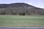
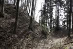
On the west of Vuiteboeuf, in the direction of Baulmes, a part of the forest is called Bois des Tours (Towers Wood). Nowadays, of no tower is visible, it was different during the Middle Ages. An important castle existed at this place, and Victor Bourgeois, in his Guide du Pied du jura, thinks it was the Castle of Peney, owned by the Lords of Grandson and destroyed during Burgundy wars. No archaeological excavation has been done on the site, but it appears with the ruin symbol on 1:25'000 scale national map.
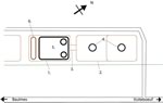
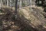
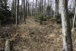
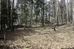
The castle is built on two hillocks connected by an passageway. Because the whole site is covered in the forrest, it is difficult to have a good idea of the commanding position of the castle, but the relief map which is visible on the cathographic web site of the State of Vaud allows understand better the importance of the site. Victor bourgeois had the possibility to see a plan of the castle drawn in 1869, and Ric Berger used this plan to make a perspective drawing in his book Le Nord vaudois (p. 175 in 1998 edition).
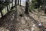
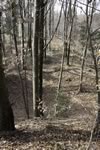
The north-est hillock is a long terace on which two big round towers were built. In 1869, the walls were still visible, but now there are only depressions on their location. Vitor Bourgeois thought the origin of these depressions because of the collapse of the towers cellar. The two hillocks are connected by a passageway which is still well visible.
On the plan made in 1869, the south-west hillock had a main building with two turrets, and also a mound on its south-west side. Nowadays, the turrets are not indentifiable and the walls of the main building are partially visible in the form of levee. The best preserved section of the wall is the east corner, with a watched height of 1 meter. The only watched section of stonework wall is on the north-west side of the main building.
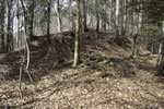
Nowadays, the mount at the south-west end of the castle is the most impressive visible remain. Its top is approximatly 2 meters higher than the level of the hillock, and it overhang the outside of the castle of 8 meters. It is not possible to know when this mound has been laid out, but it is possible that is older than the others parts of the castle. The position of such a mound on a hillock is quite similar to a celtic promontory fort.
Swiss topographic coordinates: 531'785, 184'056


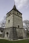
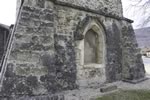
The tower of Peney
Nowadays, Peney, hamlet located 1 kilometer far from Vuiteboeuf, has a medieval tower in the center of a public square. During the Middle Ages, this tower was the bell tower of St Peter church, demolished in 1907. During the demolition, a Gothic window, which was in a wall of the nave, was taken into pieces and rebuilt in the wall of the bell tower. The construction of this tower is quite old because of the upper level of the arcade of the upper level are Romanseque style.
Swiss topographic coordinates: 533'096, 183'789