 Archeoplus
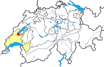
Ursins (VD)
Ursins, a village five kilometres far from Yverdon, was an important sanctuary during the Roman period. Three temples are attested and one has been transformed into a church during the Middle Ages.
Documentation
Bibliography
- Fuchs Michel, "Ursins VD et Riaz FR: mêmes combats pour Mars Caturix?", in Archéologie Suisse 20, 1997, pp. 149-158
- Kaiser Christopher, Essai de restitution architecturale du fanum d'Ursins, Lausanne, 2006
- Le livre à remonter le temps (see Bibliography), p. 168
Links
- Patrimoine du Canton de Vaud: Epoque romaine: Le sanctuaire d'Ursins: http://www.patrimoine.vd.ch/archeologie/sites-archeologiques/epoque-romaine-le-sanctuaire-dursins/
Others visible sites in the area
- Chavannes-le-Chêne (VD): Roman quarry
- Demoret (VD): Medieval church
- Gressy-Sermuz (VD): Celtic oppidum
- Molondin (VD): Medieval village of La Tour Saint-Martin
- Valeyres-sous-Montagny (VD): Standing stone
- Yverdon-les-Bains (VD): Menhirs, Roman castrum, medieval city (castle, museum)
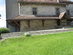
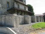
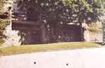
The Gallo-Roman temple
The temple is well-preserved thanks to its transformation into a place of christian worship and wich now is the nave of the church Saint-Nicholas. It is a Gallo-Roman temple (fanum), with a central worship room circled by a gallery with columns. The podium is reinforced by buttresses on the west and on the south. The entrance was at the east. Old graves allowed to discover annex buildings, including maybe a theatre or a religious amphitheatre. In 2003, two new temples and a third building have been discovered by aerial photography. One of these photographies is visible in the book Vu du ciel (see Bibliography).
Swiss topographic coordinates: 541'108, 176'311