 Archeoplus
Mont-la-Ville (VD)
One of the most beautiful stones with cup holes is visible there.
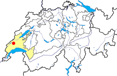
Canton: Vaud
Swiss topographic coordinates: 521'179, 166'727
Google Earth files:
OpenStreetMap: https://www.openstreetmap.org/node/240027031
Documentation
Bibliography
- Berger Ric, La contrée de Morges et ses monuments historiques (see Bibliography), pp. 132-133
- Bourgeois Victor H., Les Monuments Mégalithiques le long du Jura suisse (see Bibliography), pp. 45-46
- Burri-Wyser Elena, « Stèles ornées, menhirs sculptés et pierres à cupules, un regard sur les mégalithes vaudois » (see Bibliography)
- Cardinaux Stéphane, Géométries sacrées (see Bibliography), pp. 122-123, 272
- Delacrétaz Pierre, Pierres Mystérieuses (see Bibliography), pp. 45, 102-103
Links
- La Pierre aux Ecuelles de Mont-La-Ville: http://www.visinand.ch/Blocs_erratiques/Vaud/Mont-la-Ville-Pierre_aux_Ecuelles/Mont-la-Ville-Pierre_aux_Ecuelles.htm
Other visible sites in the area
- Croy (VD): stone with cup holes
- La Praz (VD): cromlech
- Montcherand (VD): Romanesque church
- Montricher (VD): prehistoric refuge
- Romainmôtier (VD): Romanesque abbey church, low furnaces
- Vallorbe (VD): museum
Pierre-aux-Ecuelles
Near Mont-la-Ville village, there is a rockstone which upper side is covered by cupules. The signification of these cupules is mysterious and there are several hypothesis.
Geobiliogist Stéphane Cardinaux thinks that it is map of the celtic Salt road, whose cup holes ares steps, the main cup hole would be Mont-la-Ville, and the channels between the cup holes to indicate the road.
Swiss topographic coordinates: 521'902, 168'222
OpenStreetMap: https://www.openstreetmap.org/node/2794057596

